BarrioRadar Research: Exploring Spain Through Data
Independent investigations into Spain's property markets, neighbourhoods, transport, education and local economies. We bring together official data to reveal differences that conventional reporting can miss.
Our published research is free to read. We also undertake commissioned investigations and produce maps and data visualisations for journalists, publishers and organisations.
BarrioRadar Spain City Accessibility Index 2026
Compare all 100 largest Spanish municipalities ranked by Address-Weighted BarrioRadar Score across represented CartoCiudad address portals.
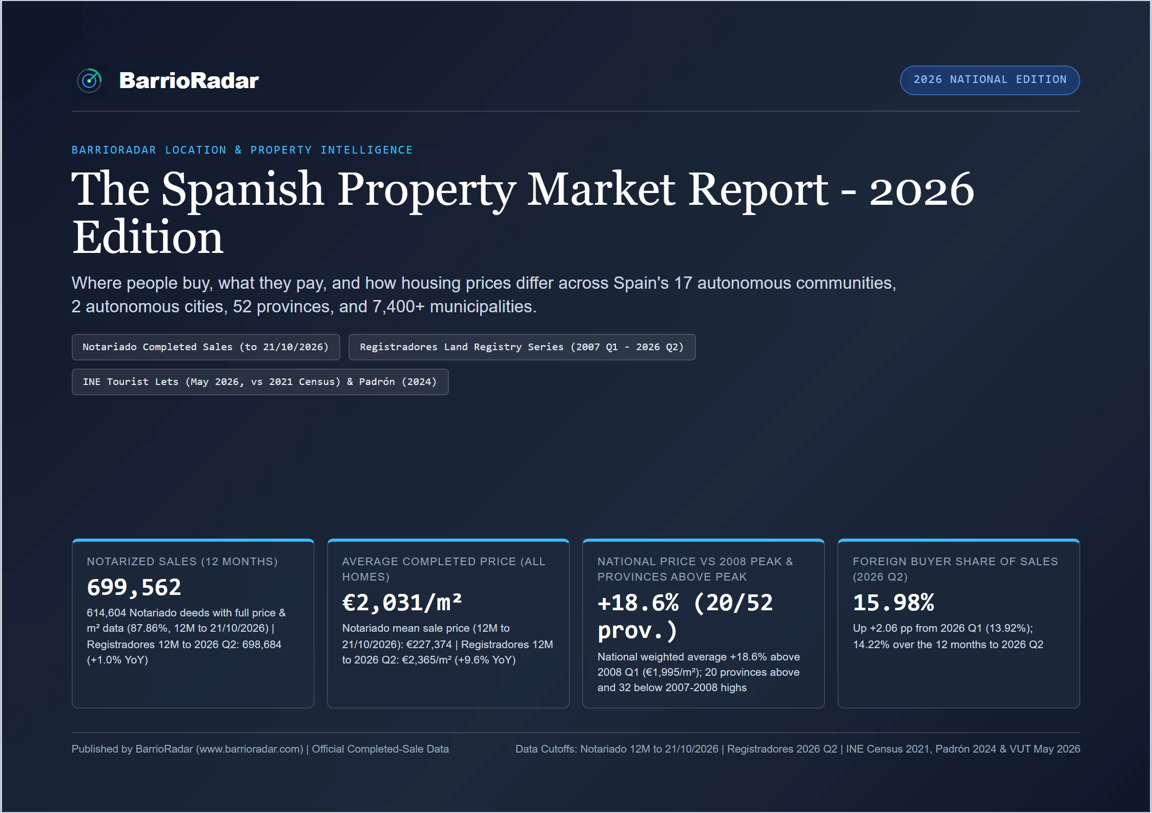
The Spanish Property Market Report 2026
A free 20-page report exploring what homes actually sell for across Spain, using official Notariado, Registradores and INE data.
Featured Investigations
Cross-dataset investigations exploring property market divides, tax policies, and spatial economics.

Seville vs Valencia: Two Very Different Maps of Holiday Rentals
Official INE data shows that three-quarters of Seville's holiday rentals are concentrated in just 10% of its census sections, compared with 42% in Valencia - revealing two contrasting spatial models across two major Spanish cities.

Where Are Málaga's 26 International Schools?
An empirical analysis of all 26 foreign-curriculum schools across Málaga province, comparing geographic clusters, stage coverage, and neighbouring Costa del Sol property price divides.
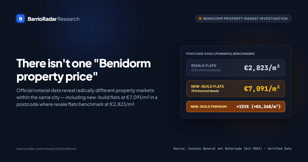
There Isn't One "Benidorm Property Price"
Official Notariado transaction data show wide divides across Benidorm's property market, including a 151% price gap between new-build and resale flats in postcode 03502.

The Single Euro That Adds EUR 20,000 in Tax - Comunitat Valenciana
An analysis of regional property transfer tax revealing how a single extra euro on a EUR 1,000,000 purchase adds over EUR 20,000 in tax in Comunitat Valenciana.

The Price of Accessibility in Spain: Accessibility and Housing Prices
A nationwide spatial study across 100 municipalities evaluating how neighbourhood pedestrian accessibility correlates with recorded property prices.
Have a research question? Let's investigate it.
From property prices to neighbourhood trends, we use official Spanish data to uncover stories worth telling. If you have an idea for a study or would like to collaborate, we'd love to hear from you.
All investigations published on this hub remain free to read and cite. For commissioned studies and custom spatial analyses, we provide verified data extracts, reproducible methodology, publication-ready charts and high-resolution maps. Where required for investigative reporting or embargoed releases, we agree clear publishing windows and delivery schedules.
Questions worth investigating
Where are property buyers getting better value?
Compare recorded sale prices, local amenities, transport access and neighbourhood characteristics.
Which areas work best for families?
Explore schools, healthcare, transport and housing affordability across different locations.
How do property taxes change across Spain?
Examine regional tax differences and how they affect the cost of buying a home.
Where are the biggest gaps in local services?
Investigate differences in accessibility, transport and essential infrastructure.
City and Neighbourhood Studies
Detailed maps showing how easily residents can reach everyday services across Spain's major cities and urban areas.

Mapping Barcelona's 15-Minute City: How Much of the City Is Within Easy Reach?
Evaluating neighbourhood reach to daily services, public transit and walkable streets across Barcelona's 15-minute city.

Everyday Access Across Madrid: Mapping Neighbourhood Reach Across the City
Mapping access to everyday essentials, transit frequencies and street networks across Madrid's diverse neighbourhoods.

Everyday Access Across Valencia: Mapping Neighbourhood Reach and Active Mobility
Examining everyday access to shops, healthcare and active mobility across Valencia's urban core and peripheral districts.

Is Alicante a 15-Minute City?
Contrasting everyday accessibility in the city centre with outer municipal districts and residential neighbourhoods.

Everyday Access Across Malaga: Mapping Neighbourhood Reach and Active Mobility
Exploring walking access and public transport connectivity across central Malaga, residential corridors and coastal fringes.

Everyday Access Across Marbella: Mapping Urban Nuclei and Suburban Spread Across 70 km2
Mapping the contrast between dense historic centres and car-dependent suburban spread across Marbella's 70 km2 coastline.

Is Sevilla a 15-Minute City?
Evaluating everyday reach to schools, groceries and public transport across Sevilla's historic quarters and outlying districts.

Everyday Access Across Bilbao: Mapping Spatial Disparities in a Dense Estuary City
Measuring neighbourhood reach and active transport across the steep topography of the Nervion estuary.
Property Buyer Guides
Practical guides for people buying, renting or owning a home in Spain. Separate from our original research.

Editorial Reuse & Media Enquiries
How journalists, publishers and organisations can reference BarrioRadar findings or collaborate on investigations.
Journalists and publishers are welcome to cite BarrioRadar findings and reproduce published charts in news coverage with standard editorial attribution ('Source: BarrioRadar'), subject to applicable statutory rights and source licences.
Publication-ready high-resolution maps, web graphics, verified data extracts and methodology documentation can be provided on request. We also welcome collaborative investigations, background briefings and discussions around exclusive publication windows or embargo schedules for forthcoming studies.
Analyse Any Property in Spain
Looking for single-property due diligence rather than research reports? BarrioRadar evaluates 0-100 scores, transit departure schedules, schools, and cadastral references on demand for 15.6M+ addresses across Spain.
Search Any Spanish Address